Distance to hike: I don't know, 10m?
Time : 4,5 h walking time to the summit, another 1,5 hours to the lakes. Including breaks i hiked 7h. From the lakes back in the valley it takes roundabout 3h.
Water: Not too much. There are some creeks during the first hour of ascent, and one during the first hour of descent. The lakes are quite clear; but you will need a filter or steritabs.
So... here it is. I had to get out, and fortunately my wife is very understanding and supports me running away once i a while. I crammed all things needed in my pack and headed of to Krün, a small village near Garmisch. At 2 pm i was ready to hike, and here is my first view: The bridge over the river Isar, leading to the "trailhead".

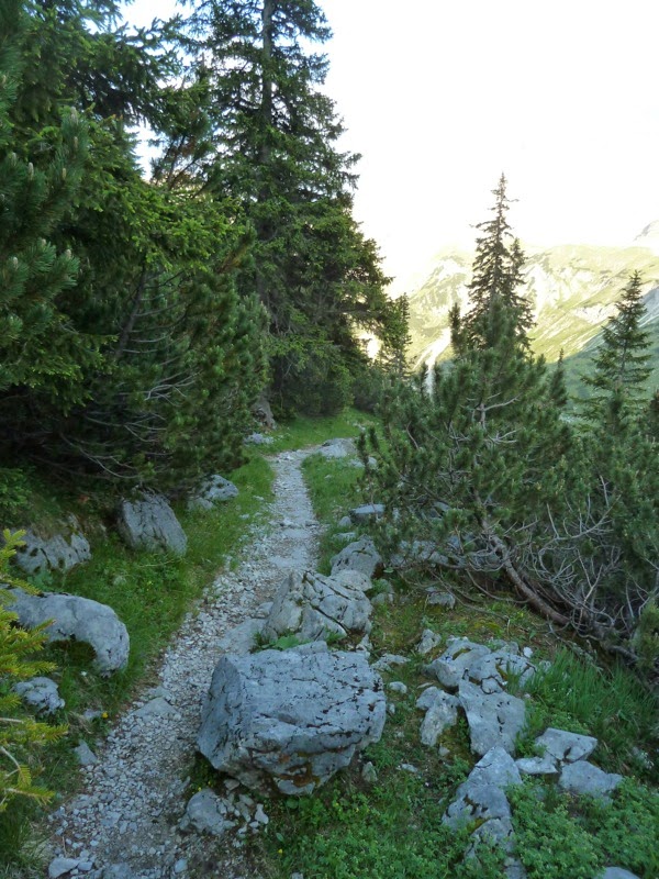
The trail starts gaining elevation very soon. And, by the way, the trail deserves the name - not a forestry road, but a real trail.

There ! Can you spot the cross on the summit? First i thought it's the Schoettelkar Peak but it ain't... i still have to look up what peak i took a picture of. Anyway, i found it to be quite impressive :-)


And on it goes... the higher you get, the more rugged the trail gets.


First view to the valley. In the Background you can spot the Barm Lake.

My trusty companion, an arc'teryx echo pack. A bit of the heavy side, but indestructible and comfortable to carry. And, of cause, my Bergstock.

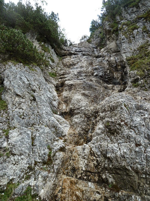
First, and only source of water during the ascent: A small creek pouring down the rocks.
There it is, the first view to the Schoettelkar Peak. it is the peak on the right side, in the background. Still a good distance to hike.

And once again, zoomed this time.


... until i reached the first peak, the Seinskopf.


A Bird came by to see if i was willing to share my noodles - no i wasn't.


for the next mile the path goes on without gaining to much elevation. It follows the contour; so you don't see too far ahead. Which creates room for surprises.

And theres is the first surprise: Two chamois (i stll hope it's the right word in english, the dictionary said so) in front of me. They were more curious than shy, so i had the opportunity to take a view shots of them:


A view in the Kar (cirque); a sort of valley that is name giving to all the Kars in the Alps. The shape was created by glaciers.

The summit in front of me.

...and here we have the first view to the Soiern Lakes, the endpoint of todays hike.


Right on top.


The Soiern Peak,.

Unfortunately i took no pictures on the first part of the descent. It was steep, and narrow, and full of gravel. and my knees were aching, so i'd thought i should rather hold on to my walking stick than to the camera. Anyway, when i made it through the worst part of it, i spotted another chamois. Can you spot it in the next picture?

There it is, zoomed:


This is how the trail continued. I just had stowed away the camera an was still hyped from having seen the next chamois, when i heard the typical sound of loose gravel, being hit by a step ("click-e-dee-click..."). So i took the camera, and sneaked around the next bush...
... and there she was, a mother with her four young ones. You can see her right in the center of the picture...

... Here again a zoomed shot...

... and after walking on for the next 500 yards, there was the next one . Hate to say but i was getting bored. Ha just kidding, no i wasn't. :-)

The trail and the valley...


...and finally, the lakes !

Dinner Time : Got the stove going, and there was rice and spam tea on the menue.


My view in the morning. Quite beautiful :-)


Sleeping room.

Bathroom...


...and Kitchen.


This is how the trial went on, quite narrow...


... before one finally reaches the Fischbach Alm.

From there on , its forestry roads...


... quite until one reaches the parking lot .

Thanks for looking :-)